
October, 2013
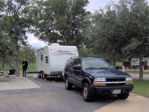
We got to the Bastrop KOA with plenty of daylight left so backing into our site and hooking up the utilities was fairly easy. Supper however was late but in the trailer that wasn't any problem.
It does seem a little wrong to call this a "campsite". The pad for the trailer was paved and very level. There was a picnic table plus room for our chairs and small folding table. The weather was good; dry and cool but did require a coat the next morning. |
 |
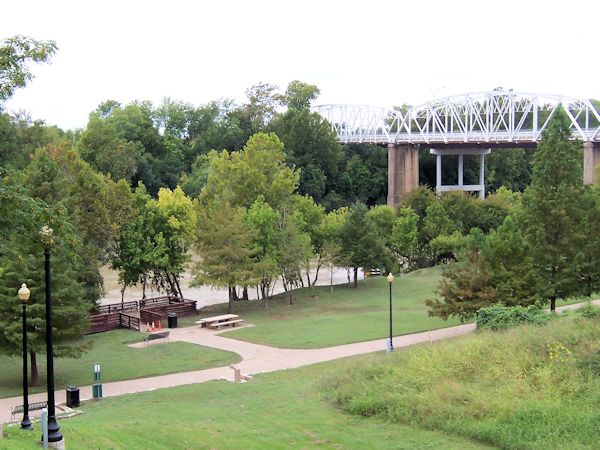 |
Although Bastrop now includes both sides of the Colorado River, there are only two highway bridge crossings. This third bridge is an old one for the original route of highways 21 and 71. It's now only for foot and bicycle traffic. A newer bridge for highway 21 is next to it, although all you can see in this picture is the new white support. A third new bridge carries highway 71 and is about a mile downstream. That little park next to the river is part of a walking trail that extends along the river through most of the city. During the floods a week earlier it was under water. |
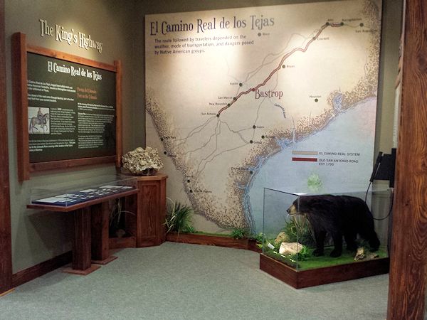
We went to the Bastrop visitors center which is housed in an old fire station and jail. They're building exhibits on the area history, although most are still under construction. A very enthusiastic lady gave us a tour of the building, including parts which were the jail and the hose drying tower of the fire station. Of course we picked up brochures for further exploration. |
 |
On the recommendation of the visitors center guide we began our walk through downtown Bastrop in the directions of the Deli Depot for lunch. The restaurant is in the Erhard Building, built in 1895. The old pressed tin ceiling, tiled entry and brass window molding are still intact. The restaurant had a special that day of a hamburger with potato salad and a carrot cupcake for desert. After all that we needed a little walking exercise. |
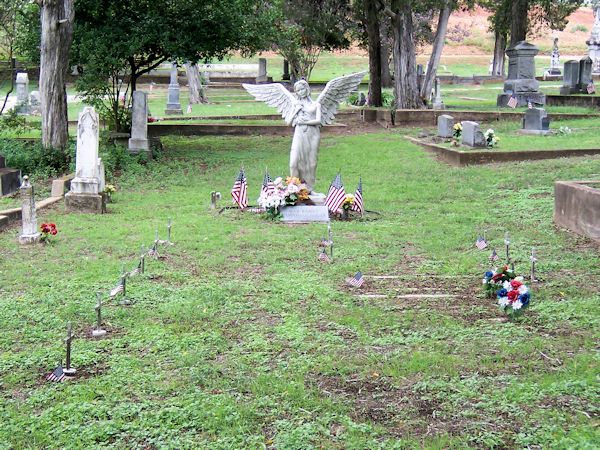 |
Part of our walking was through historic Fairview Cemetary. This cemetary was laid out by the Mexican government in 1832 although the first marked grave is from 1841. This plot is called the "War Babies". The infants buried here were fathered by soldiers at Camp Swift during World War II. The mothers had no money for a funeral so the townspeople volunteered their time and money to create this plot and provide burial services. A guardian angel monument watches over them. |
After the cemetary we drove north to the small town of Elgin, pronounced with a hard "G". This old train station doesn't see any passenger trains these days and is now used as a historical museum for the town and is loaded with memorabilia. The collection of old photographs is amazing. We could only look at a small sampling. It was interesting to see that the station had two public entrances, two ticket counters and two waiting rooms. Segregation was still common when the station was in service. | 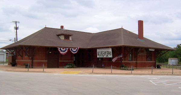 |
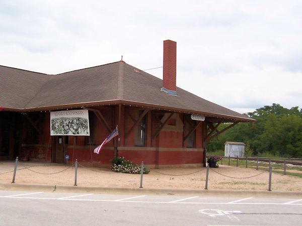 |
The station stands at the crossing of two railroads and served both. There used to be a tower at the crossing, built after two freight trains collided. While it didn't stop, an Amtrak passenger train did roll through this crossing a few days before we visited. Due to the flooding in Austin the train had to detour, which brought it through a half dozen towns that no longer have passenger service. |
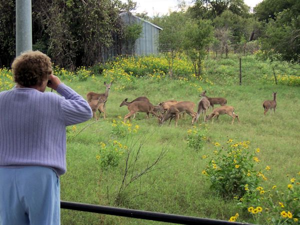
When we got back to our camp the deer in the field behind us were out. One of the other campers had thrown some deer corn into the field and it attracted a dozen or so. I'm not sure how wild these deer are but they're certainly acclimated to being around humans. Naturally we had to take pictures. |
 |
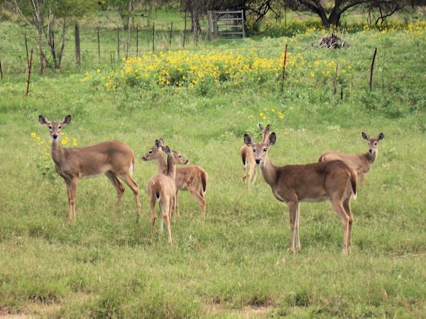 |
The deer looked up, but didn't spook when I moved in to take a close up. I imagine they've seen many humans with cameras. |
The next day we headed west to Austin and McKinney Falls state park. The small park lies along Onion Creek and offers camping, hiking, picnicking. It gets a lot of visitors as it's really in the suburbs of Austin. The floods did inundate parts of the park earlier in the week but most had dried up by the time we visited. |
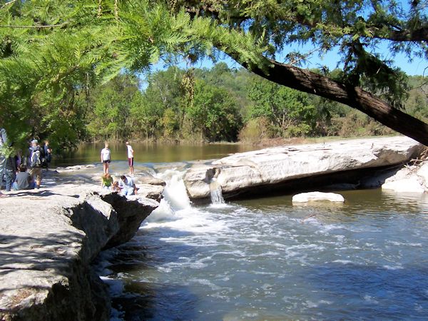
While the Upper Falls are not on the scale of Niagara, they're still beautiful to see. Some of the younger visitors would jump over the channels. We decided that would not be a smart move for us. |
 |
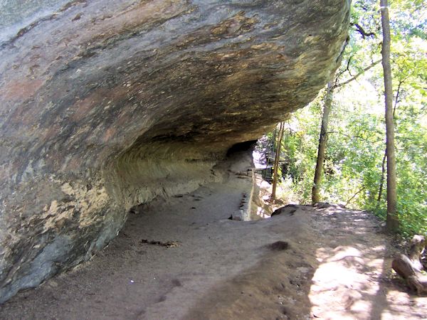 |
After the falls we took the "Rock Shelter" hiking trail. This natural shelter was used by early inhabitants of the area. It was well above Onion Creek and safe from flooding. That little retaining wall was built later to keep tourists from accidentally sliding down the slope to the creek. |
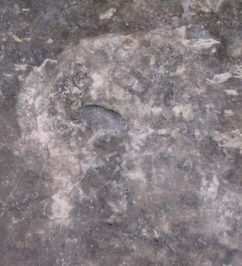 |
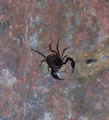
The walls of the shelter are easily touched by tourists, so I'm not sure if these are really a petroglyph and a fossilized scorpion. But they look like it. |
 |
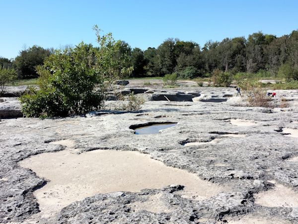
We ended up going a lot further than the Rock Shelter trail. This is called the Boulder Area although it looked a lot like the pot hole areas we've seen along the St. Croix river in northern Wisconsin and Minnesota. There even were small pebbles in some that would do the grinding. Others were just filled with mud from the recent flood. |
 |
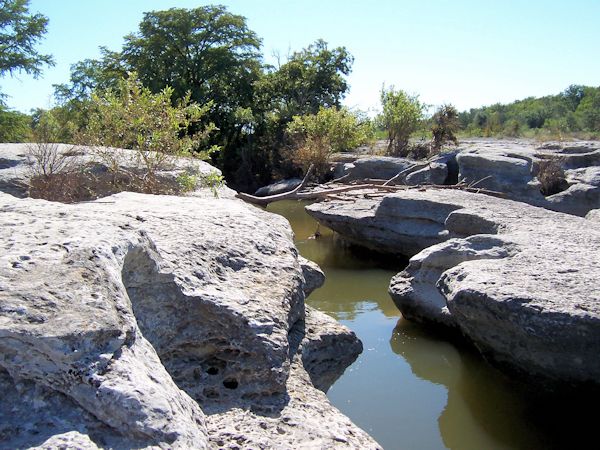 |
The lower falls is smaller than the upper; more like a series of miniature canyons where the creek has carved through the rock. Nonetheless it was interesting to see. For a "creek" this sure moves a lot of water. |
We had a great few days mini-vacation, visiting parts of Texas we've never seen before. And the weather was perfect. We missed the rain and floods of the previous weekend and left before the rains and floods the following week. |
| Part One |
|