February, 2009
On Friday we made our visit to the Hawai`i Volcanoes National Park. This was a highlight of the trip for me. Where else can you see, hike,and drive around an active volcano? The park is on Kileauea volcano. Three others that form the Big Island are Mauna Loa, Mauna Kea, and Hualalai. Of the four, only Kileauea and Mauna Loa are active. And these days Mauna Loa is just barely active. |
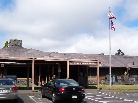 |
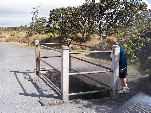
The first stop was the park headquarters for an over-view and information on what we could see. I was impressed with the knowledge and enthusiasm of the staff. We learned a lot about the park and volcanoes, especially which areas were closed to visitors. |
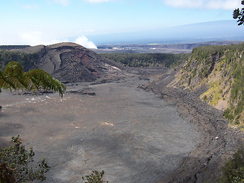
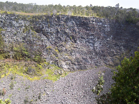
After the visitors center we walked over to the Volcano House, a hotel, restaurants and gift shop complex. It was close to noon, and as long as we were here we had lunch. This view from the overlook there shows the Iki Crater and beyond it, the Kileauea Caldera. That rising smoke/steam cloud is the venting from a relatively new vent in the Kalema`uma`u crater. Because of that the road around the Kileauea Caldera was closed where the cloud covered the road. It's more than just steam. The vent also spews up sulfur dioxide gas and fine particles of lava. Not good stuff to breath. |
 |
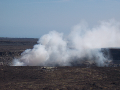 |
We were able to drive a little closer to the vent. It was amazing. The Park has a Kileauea Webcam online. Take a look; it's interesting to see. Just remember the time difference or all you'll see is darkness. |
Near the spot of the above picture were some steam vents. Rain water flows down cracks in the ground and meets the hot lava. The resulting steam, and it's just steam, vents out of the ground. Here Jackie is taking advantage of the natural sauna. There are quite a few of these around the Kileauea summit. |
 |
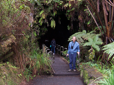 |
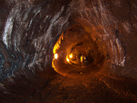
From the summit we drove down the Crater Rim Drive as far as it was open. One highlight was the Thurston Lava Tube. When lava erupts and flows down hill it often crusts over on top leaving flowing tubes underground. After the eruption stops the tube may empty, as happened here. |
The Park Service has installed lights inside this tube so visitors can walk through it. You can see some ridges on the side which show the varying levels of lava that flowed through the tube. The lava is gone, but there were many puddles of water on the floor. |
 |
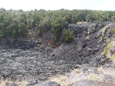 |
Crater Rim Drive was closed at the junction with Chain of Craters Road. We took that road and saw some of the many craters from past eruptions along the way. This is Lua Manu Crater. The lava flow here was from 1969. |
And another crater, Puhimau, from a flow sometime during the 1969 to 1974 period. I must admit, along this road many of the craters all look alike. But they do vary in size, and this is one of the largest. |
 |
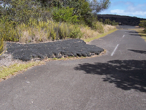 |
We turned off the main road to a little rest area and trail head for a trail across the lava. We only walked down this road to the big lava flow in the distance, but found it interesting to see how this old lava flow that had covered the road. The lava was from the 1969 to 1974 eruption. At the end of the exposed road it was at least 15 feet deep. |
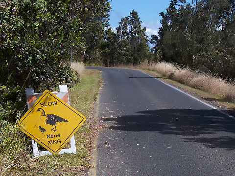
Also at the rest area we saw this Nene Crossing sign. The Nene, a Hawaiian Goose, is the State Bird of Hawaii and a critically endangered species. Although we saw many signs like this we never saw a Nene. |
 |
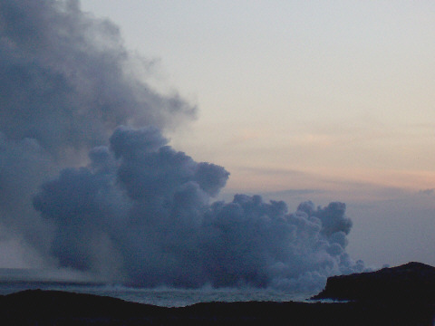
The Chain of Craters road continues down to the ocean where it turns east along the coast. Or it used to. The road ends at a 2002 lava flow. We didn't go that far as it was getting late and we wanted go that evening to a point were lava is presently entering the ocean outside the park. |
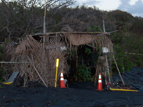
The Hawaii County viewing spot, near what was the town of Kalapana, is run by the Hawaiian Civil Defense. The drive to it crosses an old lava flow from about 1990. That flow also covered Kalapana. The county paved some asphalt on top of the lava but it's not much of a road. From the parking lot it's about a half mile hike across the rough lava rock out to the viewing area. This little hut says "Information" but I didn't see anyone there. |
 |
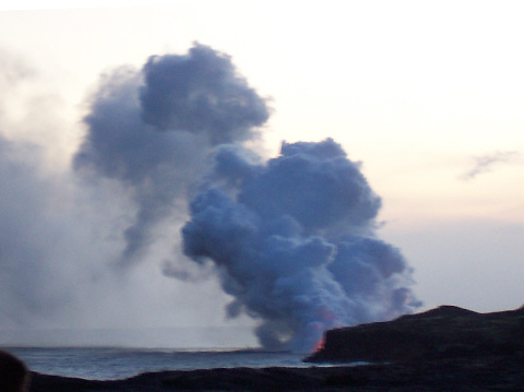 |
We got to the viewing spot near sunset. The trail across the lava is marked with reflective tape, similar to that used to mark highways. All visitors are required to have a flashlight as the walk back to the parking will probably be in the dark. We carried three, just to be sure. |
I'd estimate there were about 3 dozen people at the spot at any given time. People came and went. Here it's getting a little darker and the wind has picked up, blowing the vent cloud further out to sea. But it's still hard to see the reddish glow from the lava. The lava isn't flowing on the surface but through tubes which exit a cliff above the water line. |
 |
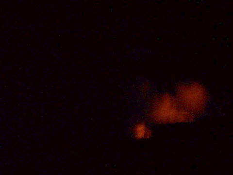 |
Finally it got dark and we could see, and photograph, the red glow from the lava. Every five or ten minutes some hot lava would suddenly drop into the cold ocean and explode, sending a shower of sparks into the air. The crowd would all "oh!" and "ah!", just like at a Fourth of July fireworks display. But those shows were so unexpected I couldn't get a picture. |
After a while we hiked back to the car. I thought driving out on a black asphalt road on black lava rock would be difficult, but it was fairly easy. The Civil Defense people don't allow anyone to enter the one lane road after 8 o'clock so if you leave after then you know you won't meet any oncoming traffic. On the way back to the cottage we stopped at the Malama Market in Pahoa and bought some Hagen Das almond cherry ice cream. It was a pleasant ending to a very enjoyable day. Tomorrow we explore a black sand beach, turtles, the southernmost point in the United States and a lava tree forest. Explore with us by clicking the usual arrow below. |
| |
|